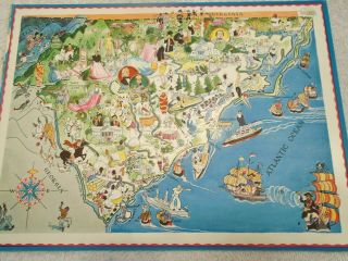
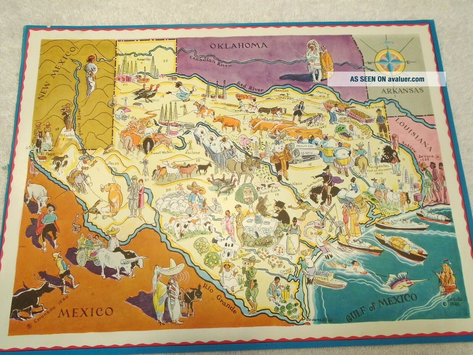
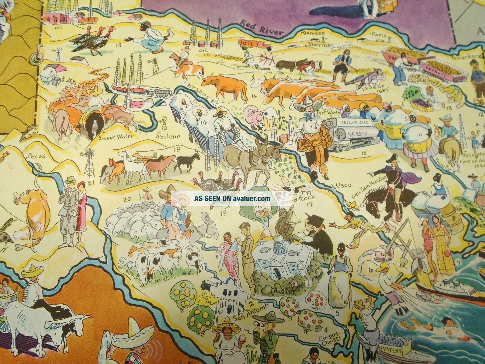
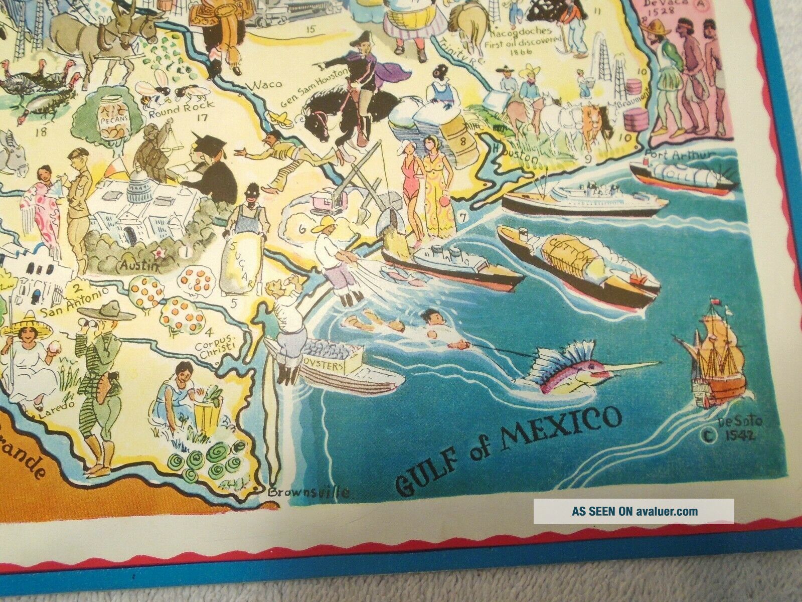
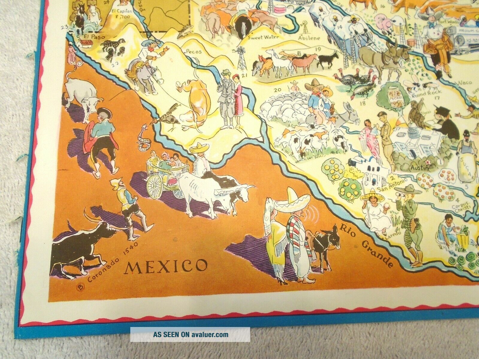
Berta & Elmer Hader 1932 Pictorial Character State Map Of Texas 9 X 12


Item History & Price

Information:
Reference Number: Avaluer:16353Cartographer/Publisher: Berta & Elmer Hader
US State: TexasOriginal/Reproduction: Antique Original
Date Range: 1930-1939Type: Pictorial/Bird's Eye
Country/Region: United States of AmericaYear: 1932
Original Description:
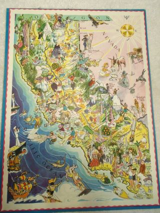
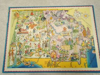
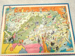
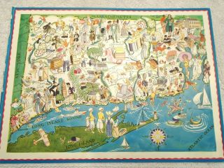
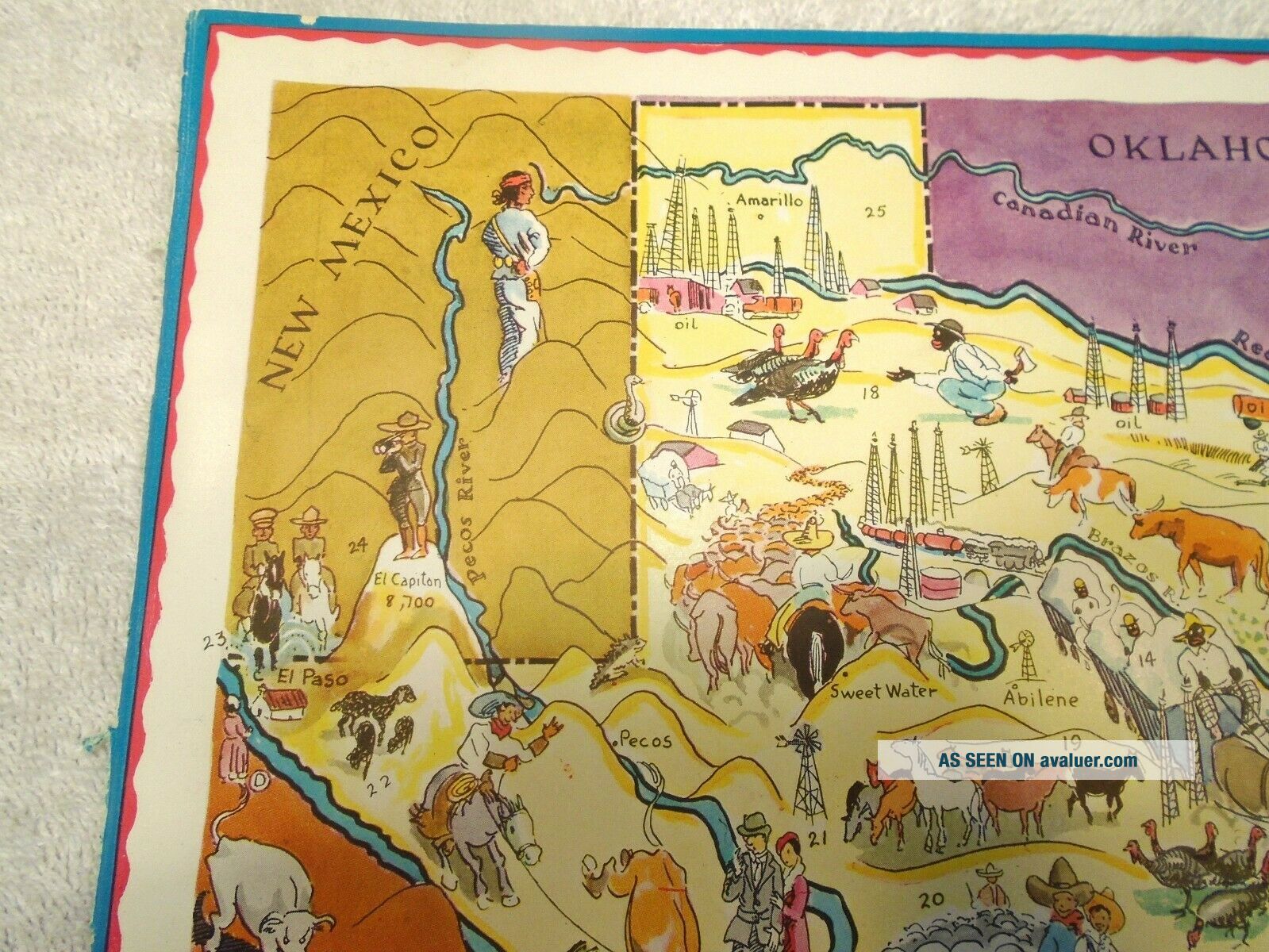
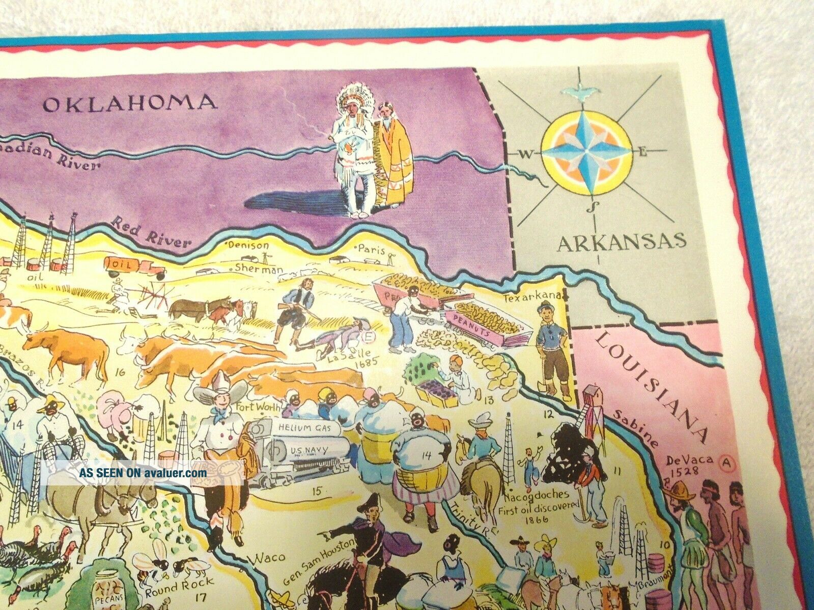
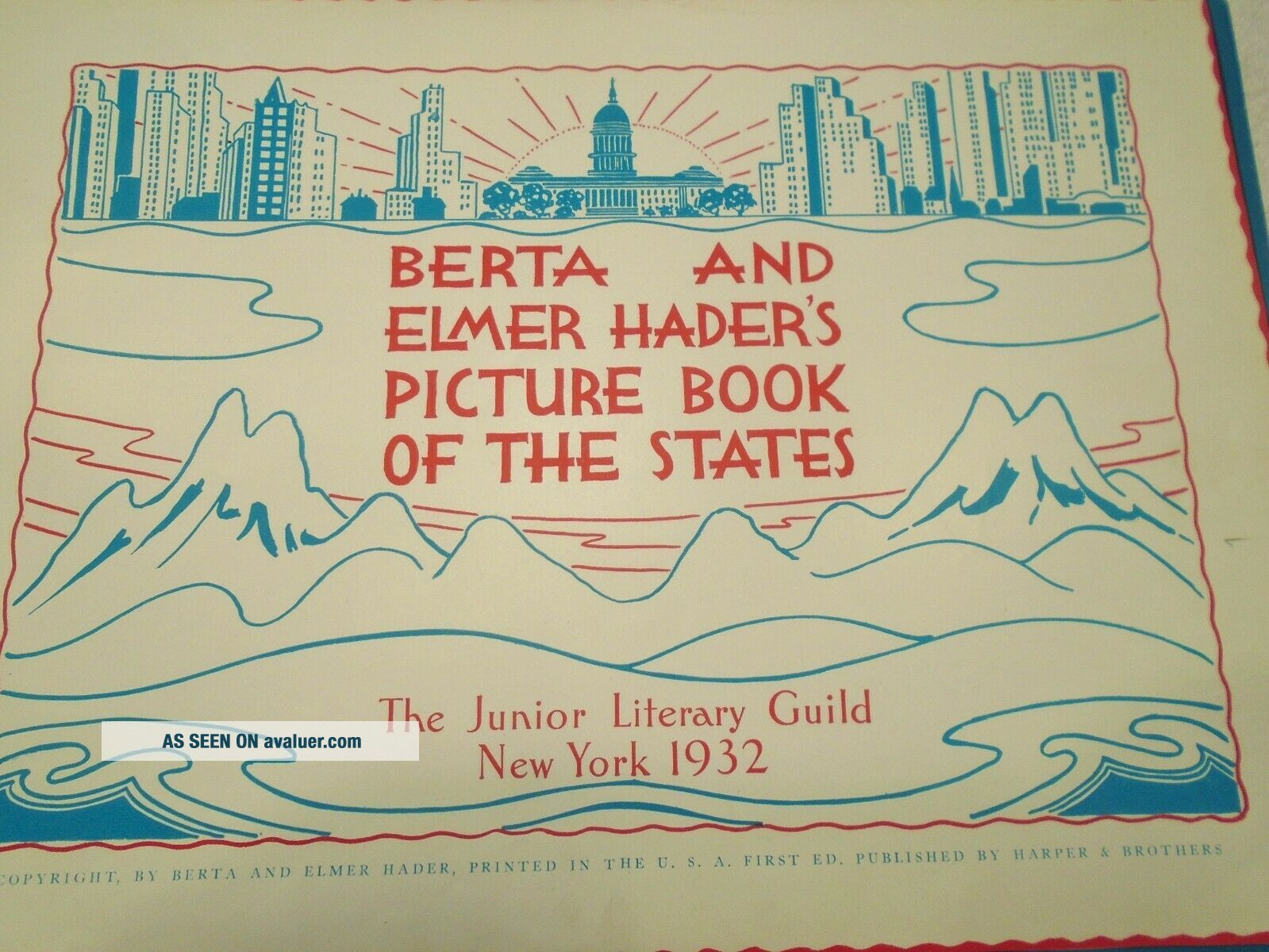
Berta & Elmer Hader Pictorial Character Map of TexasImage is 9 x 12 inchesBeautiful GraphicsThis is from the 1932 Picture Book of the States (48 at the time)Includes images of State Landmarks, Industries, Crops, Historical Landmarks, State Pastimes and Presidents who were born in the State (as of 1932) Some of the images are not considered "Politically Correct" but I really don't think we should censor artwork...do you?Happy to answer any questions.Free USA shipping

...

00005


    Similar items


  • Berta & Elmer Hader 1932 Pictorial Character State Map Of California

    Berta & Elmer Hader 1932 Pictorial Character State Map Of California

  • Berta & Elmer Hader 1932 Pictorial Character Map Of Alabama & Georgia

    Berta & Elmer Hader 1932 Pictorial Character Map Of Alabama & Georgia

  • Berta Elmer Hader 1932 Pictorial Character Map Pennsylvania Jersey

    Berta Elmer Hader 1932 Pictorial Character Map Pennsylvania Jersey

  • Berta Elmer Hader 1932 Pictorial Character Map Rhode Island Connecticut

    Berta Elmer Hader 1932 Pictorial Character Map Rhode Island Connecticut

  • Berta & Elmer Hader 1932 Pictorial Character Map North & South Carolina

    Berta & Elmer Hader 1932 Pictorial Character Map North & South Carolina

  • Berta & Elmer Hader 1932 Pictorial State Map Oregon & Washington 9 X12

    Berta & Elmer Hader 1932 Pictorial State Map Oregon & Washington 9 X12

  • Berta & Elmer Hader 1932 Pictorial State Map Minnesota Wisconsin 9 X12

    Berta & Elmer Hader 1932 Pictorial State Map Minnesota Wisconsin 9 X12

  • Berta Elmer Hader Hc Picture Book Of The States 1932 Oop 1st Edition All Intact

    Berta Elmer Hader Hc Picture Book Of The States 1932 Oop 1st Edition All Intact


    • You might also like


    • 1860 Mitchell Hand Colored Map Colorado,  Nebraska & Kansas - Civil War Era

      1860 Mitchell Hand Colored Map Colorado, Nebraska & Kansas - Civil War Era

    • 18th Century French Map Of North America

      18th Century French Map Of North America

    • Las Vegas Nevada Vintage 1967 Us Geological Survey Quadrangle Map 4 Panels

      Las Vegas Nevada Vintage 1967 Us Geological Survey Quadrangle Map 4 Panels

    • Rare Antique 1845 Maps United States Exploring Expedition Book Antartica Hawaii

      Rare Antique 1845 Maps United States Exploring Expedition Book Antartica Hawaii

    • Vintage 1926 Map Hollywood From The Best Surveys Of The Time

      Vintage 1926 Map Hollywood From The Best Surveys Of The Time

    • American Continent (western Hemisphere) 1747 Bowen Antique Copper Engraved Map

      American Continent (western Hemisphere) 1747 Bowen Antique Copper Engraved Map

    • California As Island United States 1700 De Fer Unusual First Edition Antique Map

      California As Island United States 1700 De Fer Unusual First Edition Antique Map

    • Gulf Coast Florida Texas United States 1705 De Fer Unusual Antique Engraved Map

      Gulf Coast Florida Texas United States 1705 De Fer Unusual Antique Engraved Map

Avaluer          About Us          Privacy Policy          Contact Us          UP
© 2022, avaluer.net, Inc. or its affiliates