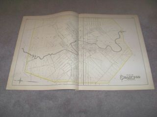
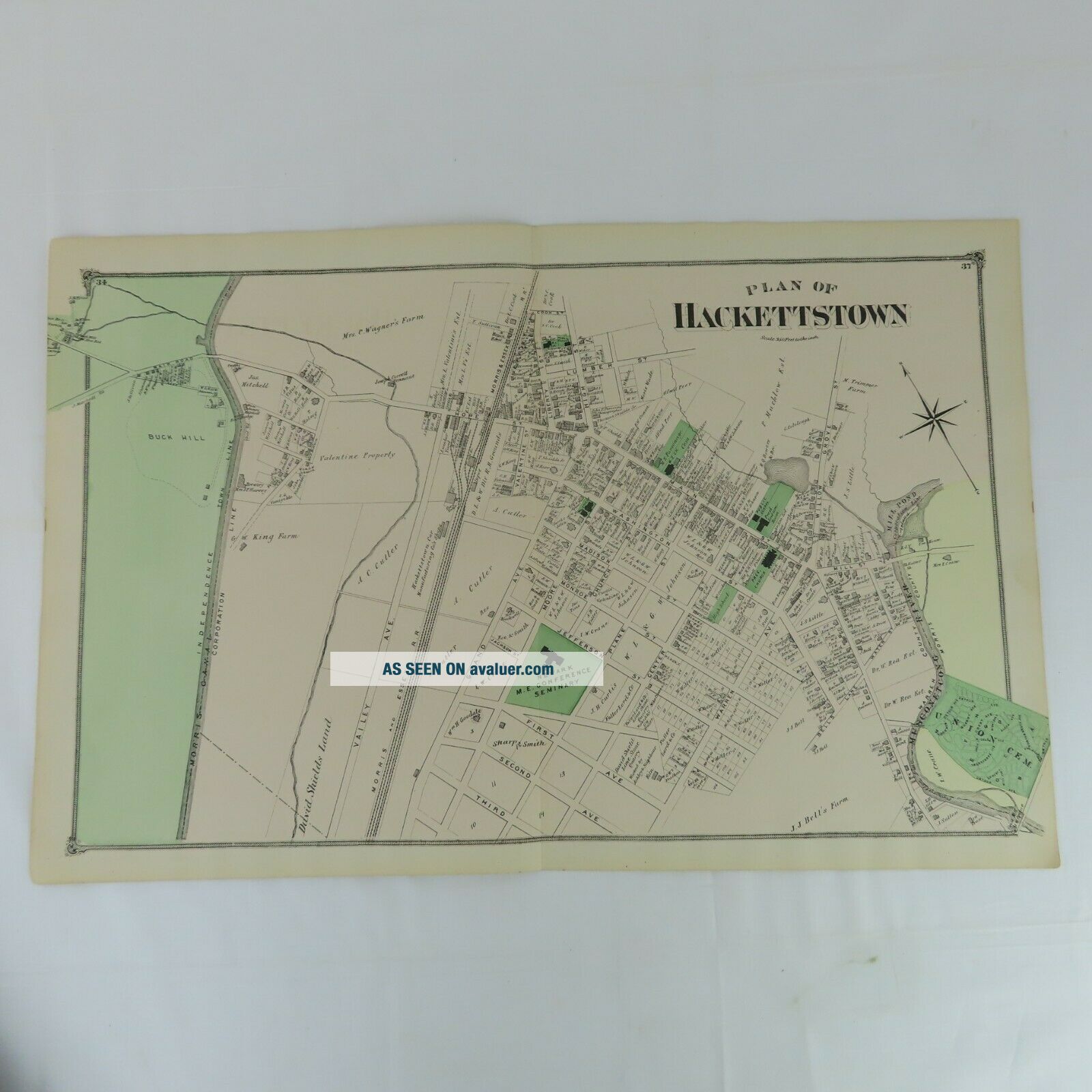
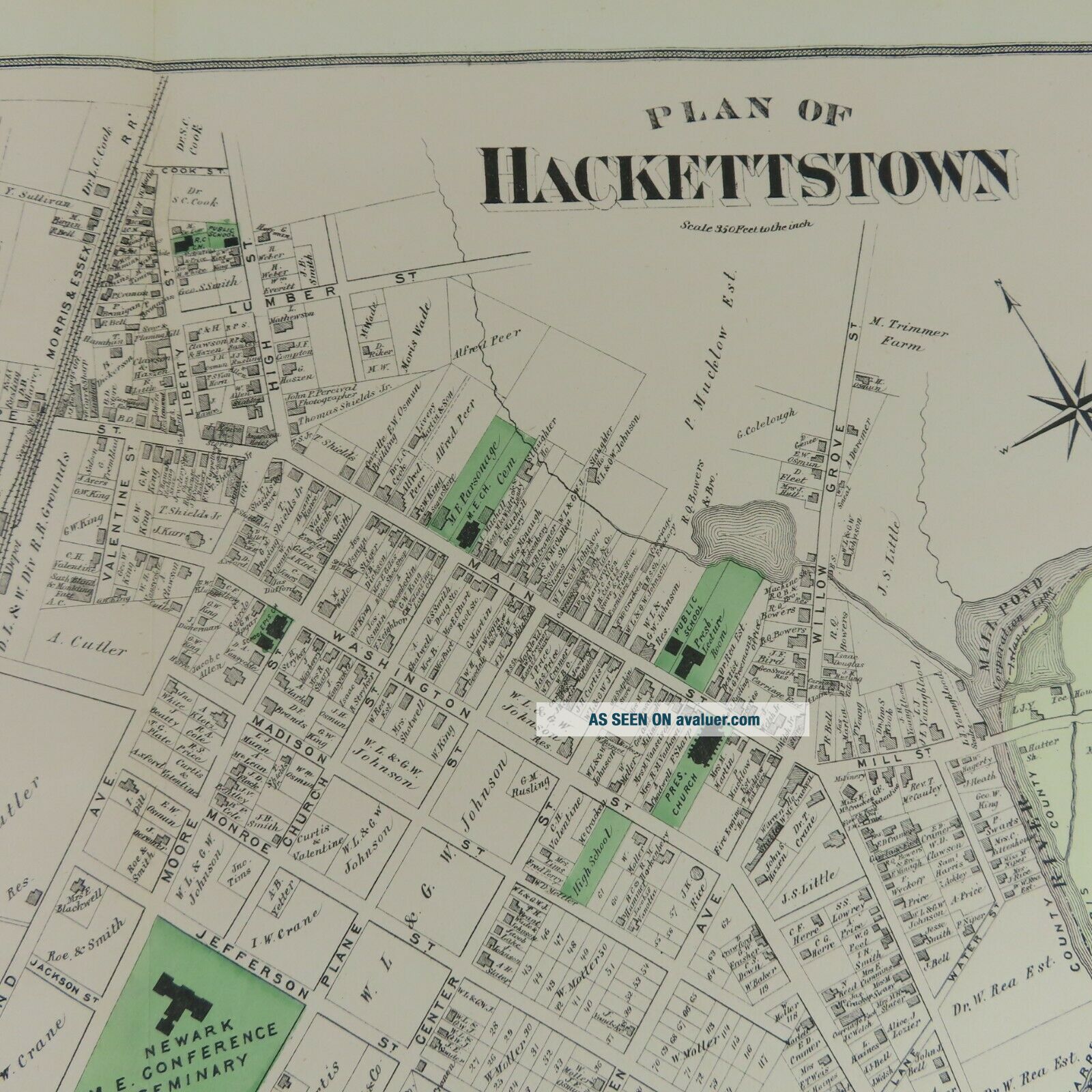
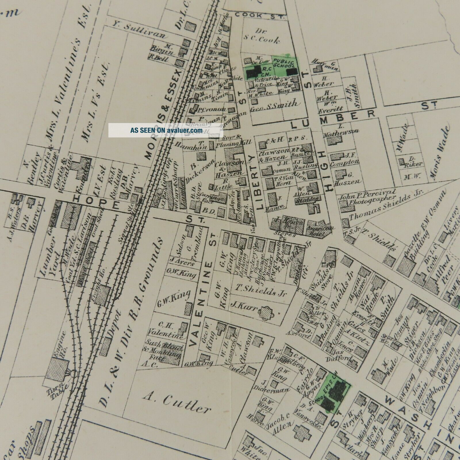
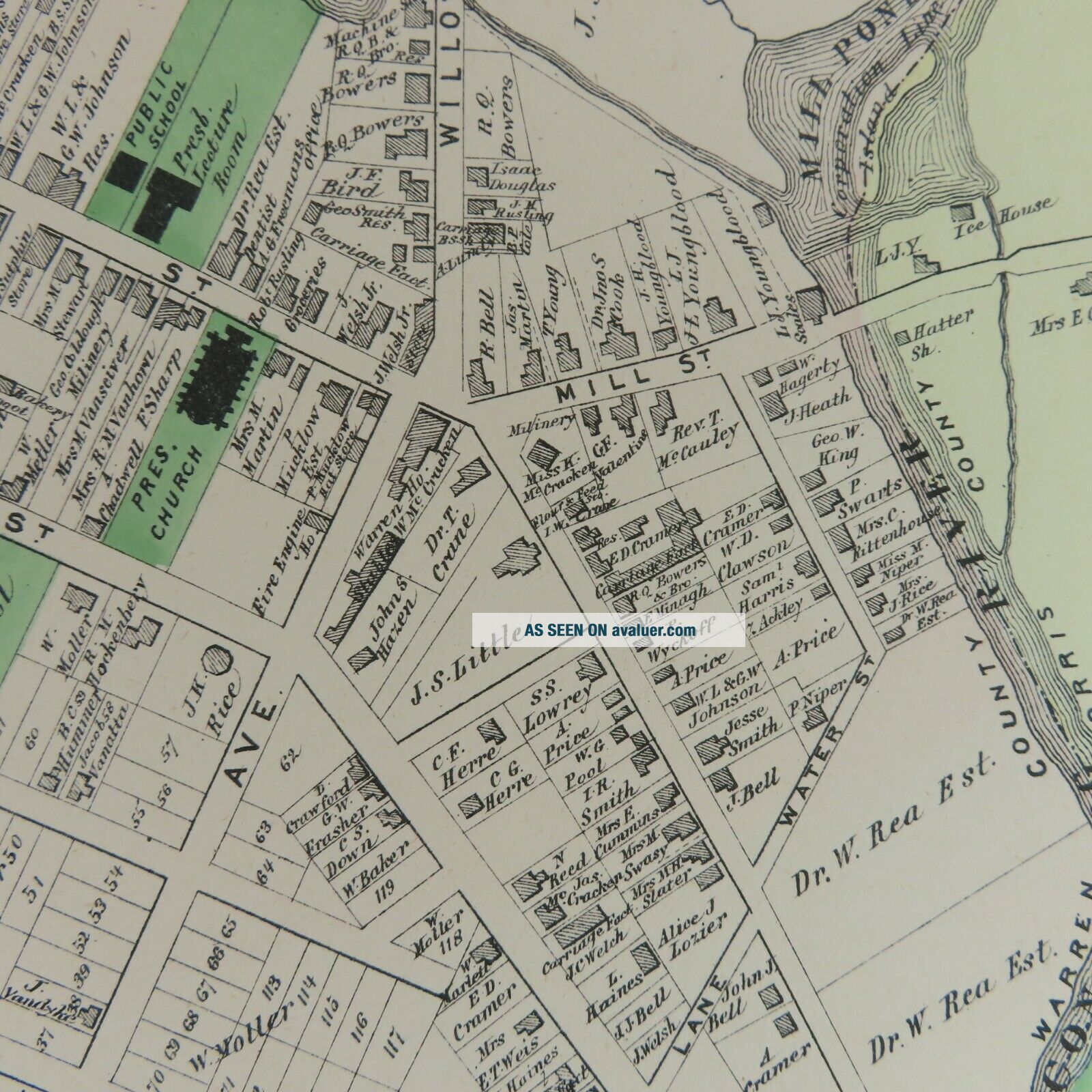
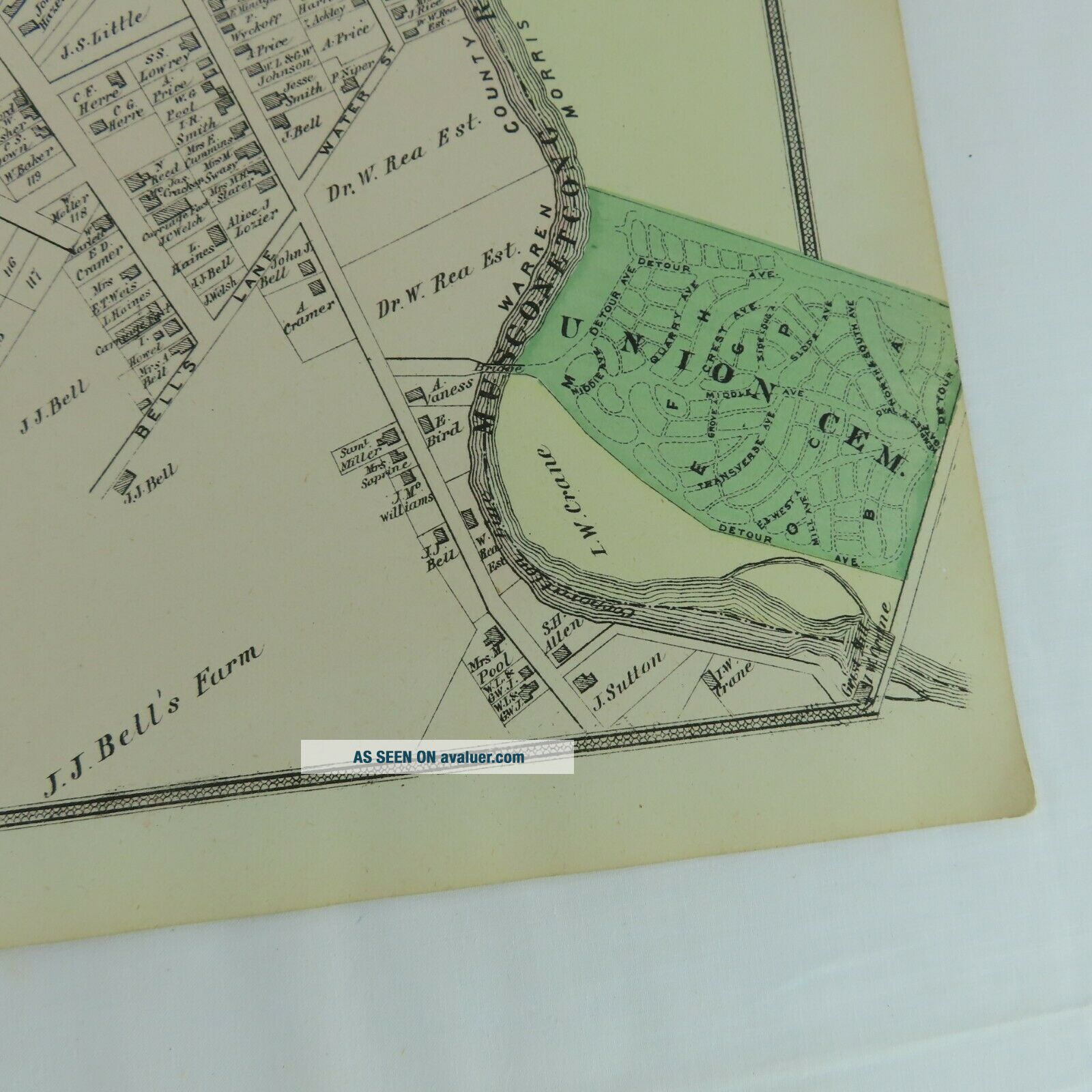
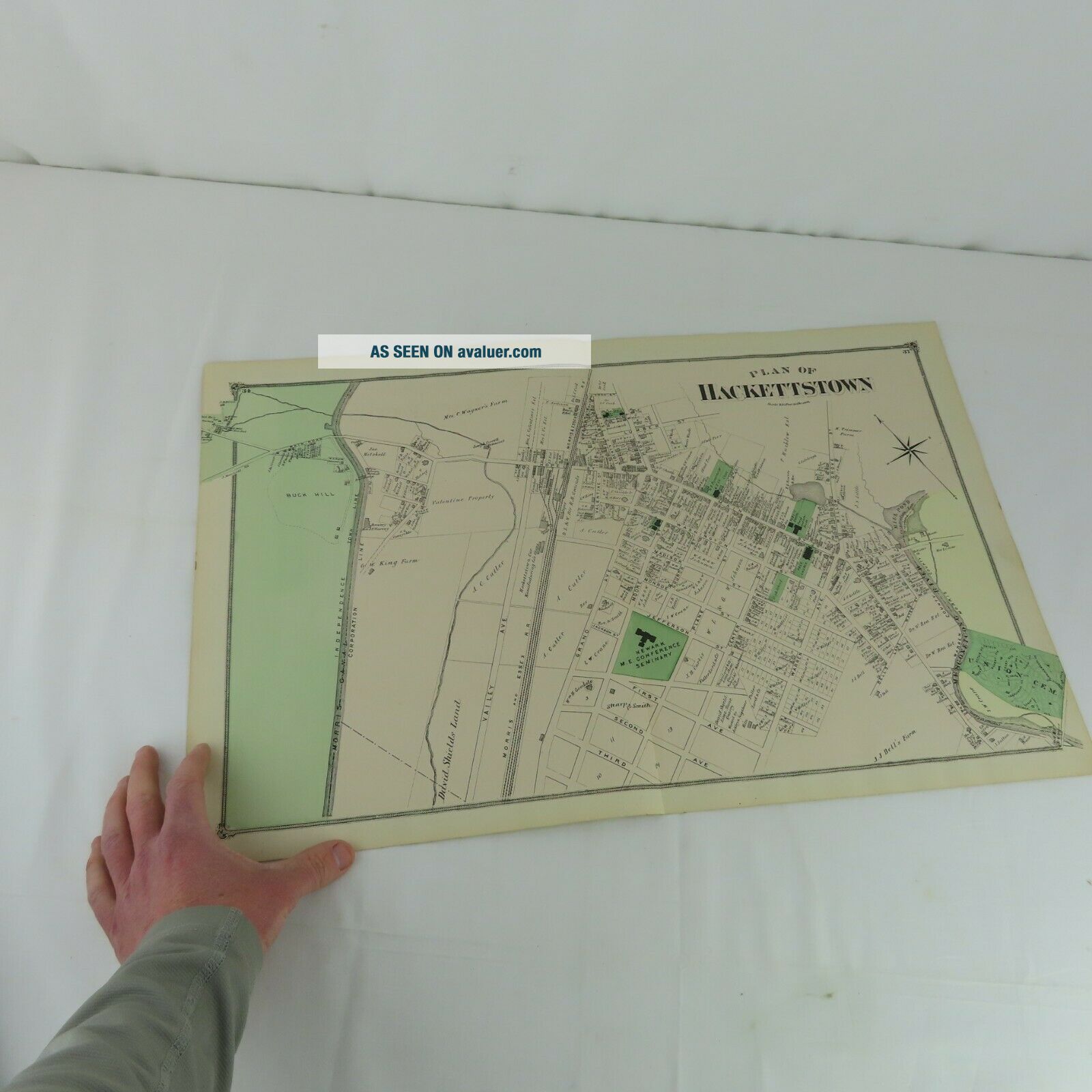
1874 Map Plan Of Hackettstown, NJ F. W. Beers Warren County 2 Page


Item History & Price

Information:
Reference Number: Avaluer:32690Subject: Reference
Year: 1874Topic: Atlases
US State: New JerseyOriginal/Reproduction: Original
Original/Facsimile: OriginalFormat: Atlas
Original Description:
This is an original map from the 1874 F.W. Beers County Atlas of Warren New Jersey published by the F. W. Beers & Co. 36 Vesey St New York.  
Perfect for framing.  
This is a two page map.
Measurements: 24" x 15-1/2"
Condition:  Some wear at the extremities. 
Will be shipped slightly rolled in a box.


    Similar items


  • 1882 Map Plan Of Cranford Township Nj J E Robinson & R H Pidgeon A H Mueller

    1882 Map Plan Of Cranford Township Nj J E Robinson & R H Pidgeon A H Mueller

  • Antique 1874 Atlas Plan Of Orleans,  Augustus Mitchell Vintage Map

    Antique 1874 Atlas Plan Of Orleans, Augustus Mitchell Vintage Map

  • Mitchell

    Mitchell ' S Antique Map " Plan Of Boston " 1860 Detailed

  • 1780s ?? Map / Plan Of Swiss Guards Barracks France - Pre - Revolution

    1780s ?? Map / Plan Of Swiss Guards Barracks France - Pre - Revolution

  • 1895 Map Plan Of Cheltenham Winter Garden Charlton Park Stations Alstone College

    1895 Map Plan Of Cheltenham Winter Garden Charlton Park Stations Alstone College

  • 1686,  Map/plan Of Moscow,  Kremlin,  Russia,  Moskva,  Kitay - Gorod,  Red Square,  St Basil

    1686, Map/plan Of Moscow, Kremlin, Russia, Moskva, Kitay - Gorod, Red Square, St Basil ' S

  • 1771 John Andrews Map Plan Of The City Of Madrid Hand Colored Engraving London

    1771 John Andrews Map Plan Of The City Of Madrid Hand Colored Engraving London

  • Antique Map Plan Of Ancient Rome,  Tiber,  Seven Hills,  Isaac Basire 1747

    Antique Map Plan Of Ancient Rome, Tiber, Seven Hills, Isaac Basire 1747


    • You might also like


    • 1860 Mitchell Hand Colored Map Colorado,  Nebraska & Kansas - Civil War Era

      1860 Mitchell Hand Colored Map Colorado, Nebraska & Kansas - Civil War Era

    • 18th Century French Map Of North America

      18th Century French Map Of North America

    • Las Vegas Nevada Vintage 1967 Us Geological Survey Quadrangle Map 4 Panels

      Las Vegas Nevada Vintage 1967 Us Geological Survey Quadrangle Map 4 Panels

    • Rare Antique 1845 Maps United States Exploring Expedition Book Antartica Hawaii

      Rare Antique 1845 Maps United States Exploring Expedition Book Antartica Hawaii

    • Vintage 1926 Map Hollywood From The Best Surveys Of The Time

      Vintage 1926 Map Hollywood From The Best Surveys Of The Time

    • American Continent (western Hemisphere) 1747 Bowen Antique Copper Engraved Map

      American Continent (western Hemisphere) 1747 Bowen Antique Copper Engraved Map

    • Gulf Coast Florida Texas United States 1705 De Fer Unusual Antique Engraved Map

      Gulf Coast Florida Texas United States 1705 De Fer Unusual Antique Engraved Map

    • California As Island United States 1700 De Fer Unusual First Edition Antique Map

      California As Island United States 1700 De Fer Unusual First Edition Antique Map

Avaluer          About Us          Privacy Policy          Contact Us          UP
© 2022, avaluer.net, Inc. or its affiliates