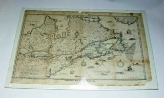
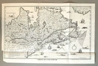
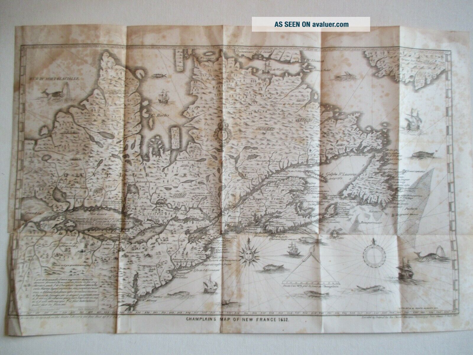
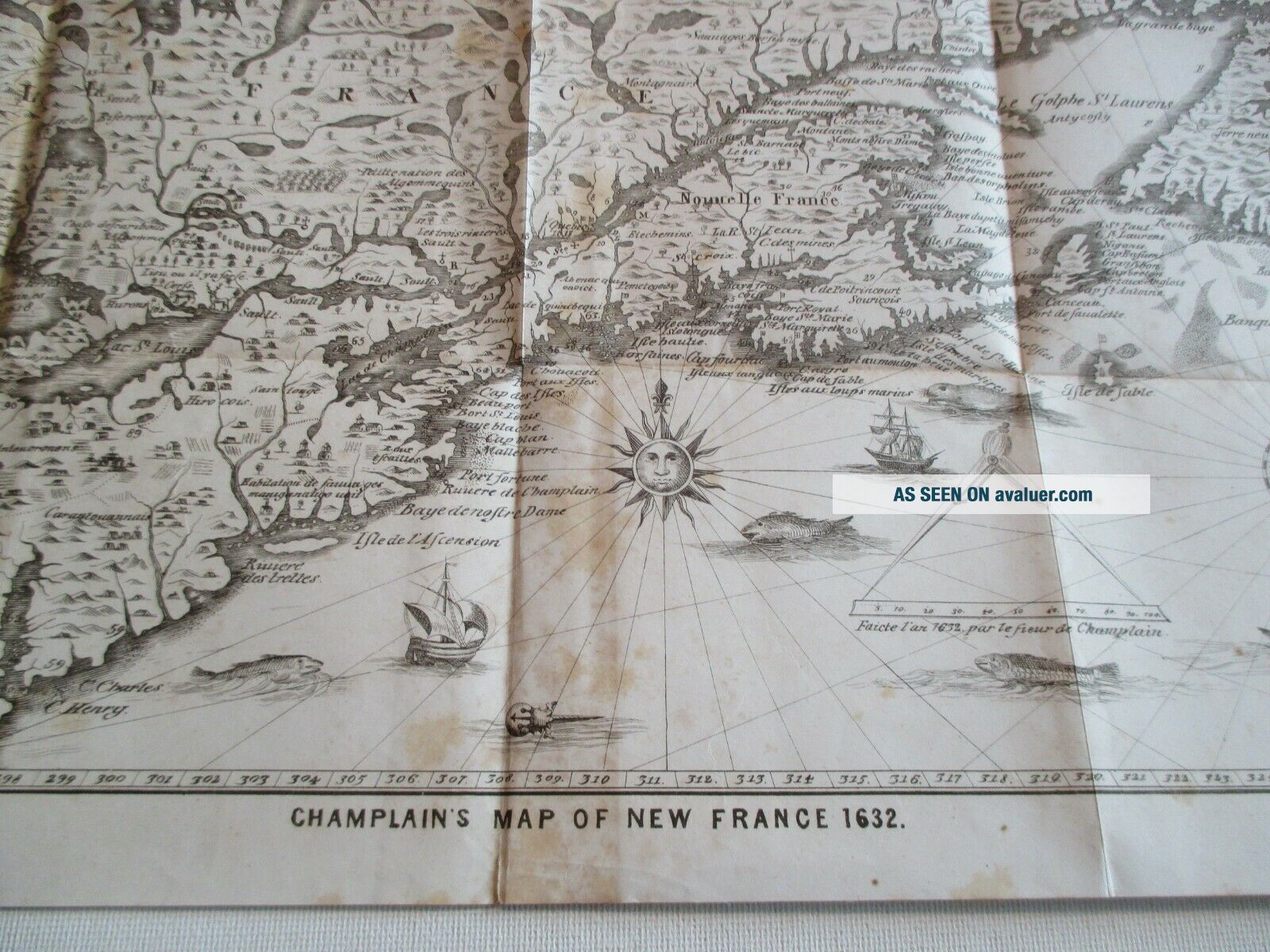
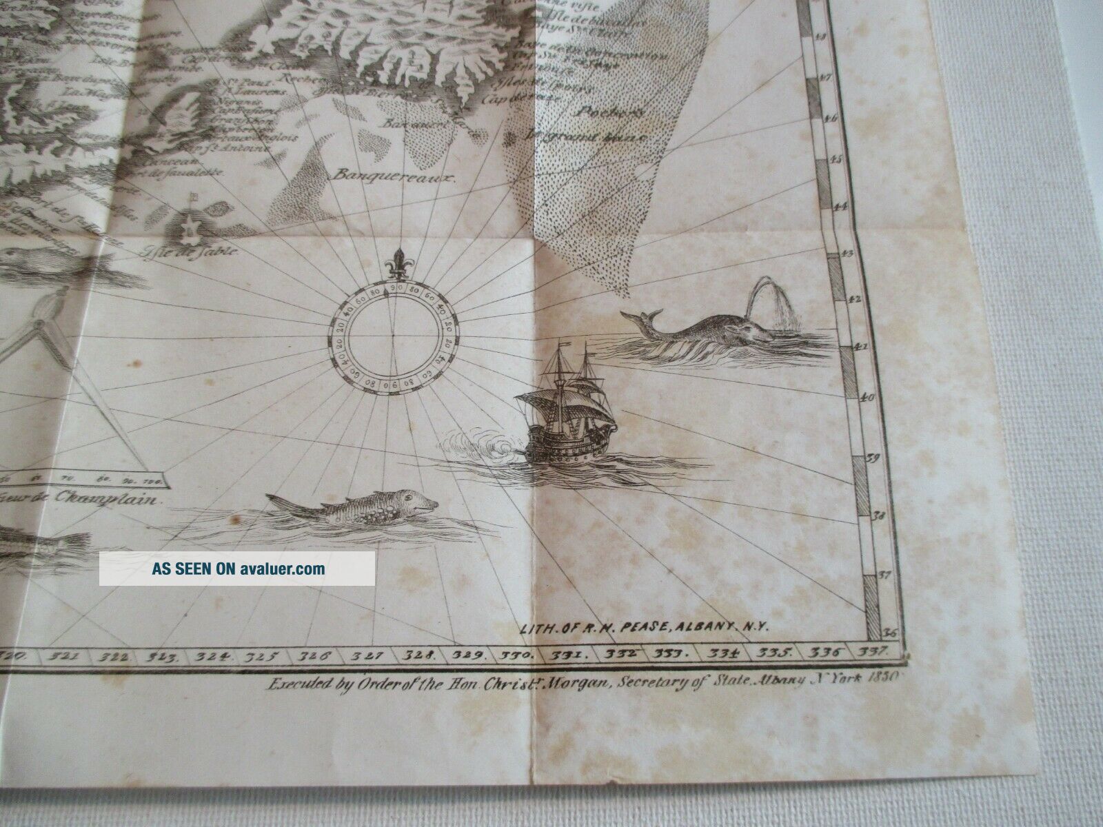
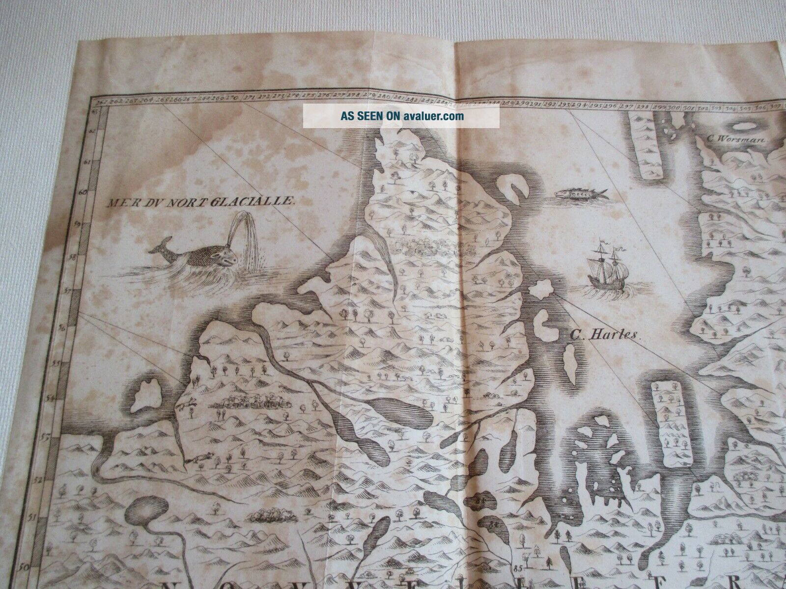
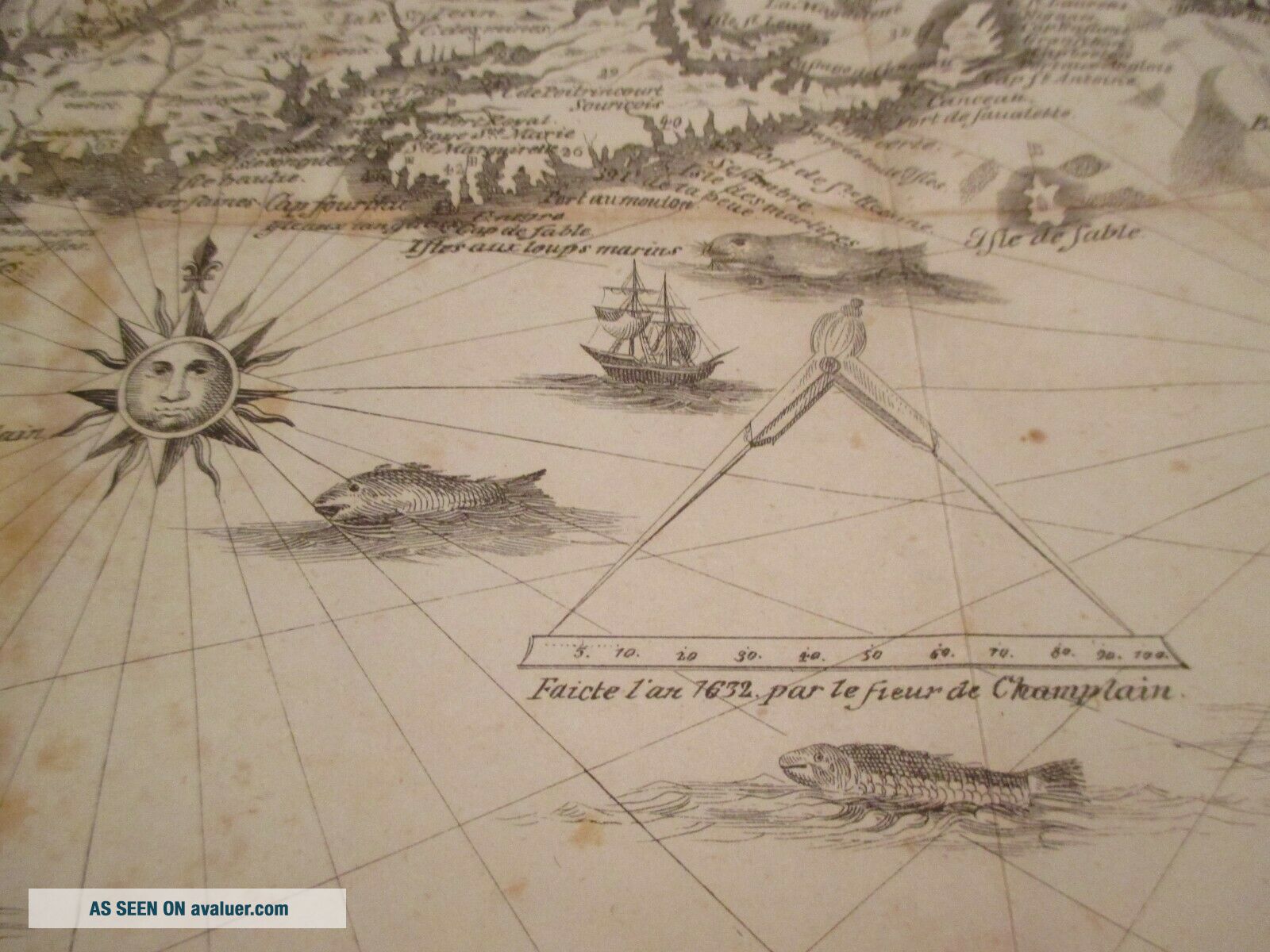
Champlain ' S Map Of France 1632, Richard H. Pease, Albany, NY, 1850


Item History & Price

Information:
Reference Number: Avaluer:44532
Original Description:
Champlain's Map of New France 1632. Reduced From the Original in the State Library for Doc. Hist. of N.Y. Vol. 3. Executed by Order of the Hon. Christopher Morgan, Secretary of State, Albany, NY, 1850.
From The Documentary History of the State of New York by E. B. O'Callaghan, M.D., Volume III, Weed, Parsons & Co., Public Printers, 1850. In good condition with one tear about 2 inches long and several other very small tears and some creases. Very foxed with some water stains but ...still very charming. Measures 11 3/4" x 18".
Thanks for the look!


    Similar items


  • Champlain

    Champlain ' S Map Of France 1632 Lithograph? 18 " X 12 "

  • Vintage Traveler

    Vintage Traveler ' S Map Of France National Geographic June 1971

  • 1892 Rand Mcnally & Co.  ’s Map Of France,  Color Fold - Out,  Antique Map And Info

    1892 Rand Mcnally & Co. ’s Map Of France, Color Fold - Out, Antique Map And Info

  • Vintage 1930

    Vintage 1930 ' S Map Of France Huge Colour Cartes Taride Nouvelle Carte 12 Francs

  • Antique 19th C.  Map Of France Champlain

    Antique 19th C. Map Of France Champlain ' S 1632 Carte De La Nouvelle France

  • 1871 Antique Map Of France,  Spain,  Portugal,  By S.  Augustus Mitchell

    1871 Antique Map Of France, Spain, Portugal, By S. Augustus Mitchell

  • H.  Gaze & Son

    H. Gaze & Son ' S Map Of Italy & South Of France - Hb/linen - Backed 1890s?

  • Vintage 1944 U.  S.  Army Wwii Road Map Of France For Use By War And Navy Dept.

    Vintage 1944 U. S. Army Wwii Road Map Of France For Use By War And Navy Dept.


    • You might also like


    • 1860 Mitchell Hand Colored Map Colorado,  Nebraska & Kansas - Civil War Era

      1860 Mitchell Hand Colored Map Colorado, Nebraska & Kansas - Civil War Era

    • 18th Century French Map Of North America

      18th Century French Map Of North America

    • Las Vegas Nevada Vintage 1967 Us Geological Survey Quadrangle Map 4 Panels

      Las Vegas Nevada Vintage 1967 Us Geological Survey Quadrangle Map 4 Panels

    • Rare Antique 1845 Maps United States Exploring Expedition Book Antartica Hawaii

      Rare Antique 1845 Maps United States Exploring Expedition Book Antartica Hawaii

    • Vintage 1926 Map Hollywood From The Best Surveys Of The Time

      Vintage 1926 Map Hollywood From The Best Surveys Of The Time

    • American Continent (western Hemisphere) 1747 Bowen Antique Copper Engraved Map

      American Continent (western Hemisphere) 1747 Bowen Antique Copper Engraved Map

    • Gulf Coast Florida Texas United States 1705 De Fer Unusual Antique Engraved Map

      Gulf Coast Florida Texas United States 1705 De Fer Unusual Antique Engraved Map

    • California As Island United States 1700 De Fer Unusual First Edition Antique Map

      California As Island United States 1700 De Fer Unusual First Edition Antique Map

Avaluer          About Us          Privacy Policy          Contact Us          UP
© 2022, avaluer.net, Inc. or its affiliates